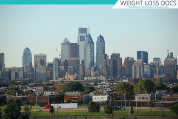
Dr. Fisher’s Medical Weight Loss and Aesthetic Centers located at 2543 Broad Street, Philadelphia Pennsylvania 19148 offers the following services:

- Medically supervised weight loss plans. Having treated 1000’s of patients who have struggled with weight, this unique diet has produced many many success stories. You could be next!
- Weight loss for children and teenagers. Many children are classified as medically obese, and as a result their health suffers, not to mention other side effects such as lowered self esteem. The weight loss program designed just for kids is designed to get them back to a healthy weight.
- The HCG diet plan. As part of the overall weight loss program, Dr. Fisher may put you on the HCG plan to accelerate loss of fat across your body.
- Non-surgical fat reduction with the state-of-the-art Vanquish fat melting technology.
- Spot fat reduction with mesotheraphy body shaping technology.
Medspa services are offered, including:
- Pellevé wrinkle relaxers
- Botox
- Lip fillers
- Microdermabrasion
Call Dr. Fisher’s office to learn more about the above services or to make an appointment.
Directions to Dr. Fisher’s Office on S Broad St.
- Dr Fisher’s office is conveniently located a few minutes walk from Marconi Plaza, near the intersection of Broad St, W Oregon Ave and W Moyamensing Ave.
- If coming on the Subway, the office is a few minutes walk from the Oregon Subway Station.
- The closest bus stop is at Broad St & Porter St.
- If driving from Pennsport, join S Front St and head south past the Edward O’Malley Sports Complex.
- Take a right on W Shunk St and head west. You’ll go by the Murphy Recreation Center.
- Turn right onto S Broad St and the clinic is immediately on the right.
About Pennsport
- Population (approx.): 26,000
- Located in Philadelphia County, Pennsylvania
- Geo coordinates: 39.9276°N, 75.1465°W
- Postal Codes: 19147, 19148
Interesting Things to See and Do in Pennsport
- The Washington Avenue Immigration Station was an immigrant processing facility located at the end of Washington Avenue at Pier 53 on the Delaware River, from 1873 to 1915.
- Mummers Parade: (S. Broad St. and S. Penn Square) Held every New Years Day. festive, often-rowdy, nearly 120-year-old tradition, 10,000 men, women and children dressed in colorfully lavish costumes twirl, sashay, pirouette and strut down the city’s main streets.
- Nathaniel Irish House: A historic home located next to the Captain Thomas Moore House. The 3 1/2 story house was built between 1763 and 1769.
- Port of Philadelphia: Located on the Delaware River. One of the largest shipping areas of the United States.
- Captain Thomas Moore House (South Front Street) Located in the South Front Street Historic District between the Nathaniel Irish House and Widow Maloby’s Tavern. The 3 1/2 story brick row house was built in 1767 and added to the National Register of Historic Places in 1972.
- Widow Maloby’s Tavern (South Front Street) The 3 1/2 story tavern was built in 1764. Originally the tavern was painted yellow. The Tavern has been a gathering place for over a century, and was added to the National Register of Historic Places in 1972.
Nearby Airports
- Philadelphia International Airport (Philadelphia)
- Northeast Philadelphia Airport (Philadelphia)
- Camden County Airport
- South Jersey Regional (Lumberton) .
- Flying W Airport & Resort (Medford)
- Hargrove (Camden)
Local Roads
- Interstate 95
- Interstate 76
- Broad Street (Philadelphia)
- Southern Boulevard (Bronx)
- Whitehall
Nearby Rivers
- Schuylkill River
- Delaware River
- Cobbs Creek
- Wissahickon
Nearby Towns and Suburbs
- Wharton is to the west.
- Whitman is to the south-west.
- Camden is 1 mile to the east.
- Center City is 1 mile to the north-west.
- Philadelphia is 1 mile to the north-west.
- Gloucester City is 2 miles to the south-east.
- Collingswood is 4 miles to the east.
- Audubon is 4 miles to the south-east.
- Bellmawr is 5 miles to the south-east.
- Haddon Heights is 5 miles to the south-east.
- Yeadon is 5 miles to the west.
- Darby is 6 miles to the west.
- Woodbury is 6 miles to the south.
- Haddonfield is 6 miles to the south-east.
- Barrington is 6 miles to the south-east.
- Runnemede is 6 miles to the south-east.
- Lansdowne is 6 miles to the west.
Schools Close By
- Furness High School
- Taggart John H School
- Eliza Butler Kirkbride School
- George Sharswood School
- Settlement Music School
- George W. Nebinger School
- Edward W. Bok Technical High School
- Saints John Neumann and Maria Goretti Catholic High School
- Francis Scott Key School
- Science Leadership Academy
Local Parks
- Independence National Historical Park
- Bartram’s Garden which is on 5400 Lindbergh Boulevard
- Centennial Arboretum which is on Montgomery Drive
- Smith Memorial Playground & Playhouse
- Cooper River Park which is on North Park Drive, Pennsauken Township
- Penn Park which is on 3000 Walnut Street
- Rittenhouse Square which is on 210 West Rittenhouse Square
- Blue Cross RiverRink which is on 101 South Christopher Columbus Boulevard
- The Oval which is on 2451 Benjamin Franklin Parkway
- Shofuso Japanese House and Garden which is on Lansdowne Dr &, Horticultural Drive
Nearby Amusement Parks
- Sahara Sam’s Oasis Outdoor and Indoor Waterpark which is on 535 New Jersey 73, West Berlin
- The Funplex which is on 3320-24 New Jersey 38, Mount Laurel Township
- Sky Zone Trampoline Park which is on 122 Mill Road Unit B-250, Oaks
- Sesame Place which is on 100 Sesame Road, Langhorne
- Sky Zone Trampoline Park which is on 10 Conchester Road, Glen Mills
- CoCo Key Water Resort which is on 915 New Jersey 73, Mount Laurel Township
- Clementon Park & Splash World which is on 4504, 144 Berlin Road, Clementon
